Monday, September 2, 2013

the city of Bagan (previously spelled “Pagan”) in Myanmar (previously called Burma) is an ancient city that is home to over 2,000 temples and pagodas. Many ancient kingdoms have claimed Bagan as their capital city throughout its history. The majority of Bagan’s 67 square kilometers (26 square miles) worth of buildings were constructed between 1000 CE and 1300 CE. Bagan became a thriving center for Theravada Buddhism under King Anawrahta’s rule in the early 1000s. Visitors to Bagan can enjoy a variety of accommodations, cuisine, and activities, including touring the city by car, bike, or horse-cart, enjoying local art, and taking a boat trip on the Ayeyarwady River.

http://beautifulplacestovisit.com/wp-content/uploads/2009/11/Shwezigon-Paya-Bagan-Myanmar-tall.jpgBagan, MyanmarBagan, MyanmarAnanda Temple, Bagan, Myanmarhttp://www.myanmars.net/myanmar-travel/myanmar-bagan/images/seddana-pagoda.jpgBagan, MyanmarBagan, MyanmarBagan, MyanmarShwezigon Paya, Bagan, MyanmarBagan, MyanmarGawdawpalin Temple, Bagan, MyanmarMonte Popa, Bagan, MyanmarMyazedi Pagoda, Bagan, Myanmar

Tanintharyi Region

 Tanintharyi Region lies at the southern end of Myanmar. The Region has common borders with Thailand on the east and south-east, Mon State on the north, and Andaman Sea on the west. The area of the Region is 16,735 square miles. Out of about 1,000 islands along Myanmar's coastline over 800 are in Tanintharyi coast. Dawei is the Capital of Tanintharyi Region.

Area & population

Mons, Salons, Myanmars, Karens, Paos, Tavoyans, and Pashus (Malaya) live in the ten Townships and 317 Wards and Village Tracts of Tanintharyi Region and the population is about 917,628.

Agriculture

In agricultural, the main crops are paddy, betel nut, coconut, rubber and dhani. Tapioca, rambutan, durian aClick here for a larger viewnd mangos teen are also grown on a large scale. Oil producing oil palm is being grown under a special project.

Resources

The Region is rich in natural resources. Famous mines are Heinda, Hamyingyi, Kanbauk, Yawa, Kyaukmetaung, Nanthida and Yadanabon which produce a lot of metals. Pearls cultured at the Pearl Island earn a great amount of foreign currency at the Myanma Gems Emporia. Arrangements are being made for the sea fishing industry along Tanintharyi coast to supply not only for domestic consumption but also for export. Birds' nest is also being gathered from offshore islands. This part of the country is the main fishery product market of Myanmar.

Tourism

The Myeik archipelago is inhabited by the Salone tribes, and yearly there are festivals and occasions to visits this place. Diving trips can also be arranged. Kawthaung is the southern most point of Myanmar and the border check point to enter Thailand.

A Myanmar Couple
Click here for a larger view

Tanintharyi Region


Tanintharyi Region lies at the southern end of Myanmar. The Region has common borders with Thailand on the east and south-east, Mon State on the north, and Andaman Sea on the west. The area of the Region is 16,735 square miles. Out of about 1,000 islands along Myanmar's coastline over 800 are in Tanintharyi coast. Dawei is the Capital of Tanintharyi Region.

Area & population

Mons, Salons, Myanmars, Karens, Paos, Tavoyans, and Pashus (Malaya) live in the ten Townships and 317 Wards and Village Tracts of Tanintharyi Region and the population is about 917,628.

Agriculture

In agricultural, the main crops are paddy, betel nut, coconut, rubber and dhani. Tapioca, rambutan, durian aClick here for a larger viewnd mangos teen are also grown on a large scale. Oil producing oil palm is being grown under a special project.

Resources

The Region is rich in natural resources. Famous mines are Heinda, Hamyingyi, Kanbauk, Yawa, Kyaukmetaung, Nanthida and Yadanabon which produce a lot of metals. Pearls cultured at the Pearl Island earn a great amount of foreign currency at the Myanma Gems Emporia. Arrangements are being made for the sea fishing industry along Tanintharyi coast to supply not only for domestic consumption but also for export. Birds' nest is also being gathered from offshore islands. This part of the country is the main fishery product market of Myanmar.

Tourism

The Myeik archipelago is inhabited by the Salone tribes, and yearly there are festivals and occasions to visits this place. Diving trips can also be arranged. Kawthaung is the southern most point of Myanmar and the border check point to enter Thailand.

A Myanmar Couple
Click here for a larger view

Tanintharyi Region

Tanintharyi Region lies at the southern end of Myanmar. The Region has common borders with Thailand on the east and south-east, Mon State on the north, and Andaman Sea on the west. The area of the Region is 16,735 square miles. Out of about 1,000 islands along Myanmar's coastline over 800 are in Tanintharyi coast. Dawei is the Capital of Tanintharyi Region.

Area & population

Mons, Salons, Myanmars, Karens, Paos, Tavoyans, and Pashus (Malaya) live in the ten Townships and 317 Wards and Village Tracts of Tanintharyi Region and the population is about 917,628.

Agriculture

In agricultural, the main crops are paddy, betel nut, coconut, rubber and dhani. Tapioca, rambutan, durian aClick here for a larger viewnd mangos teen are also grown on a large scale. Oil producing oil palm is being grown under a special project.

Resources

The Region is rich in natural resources. Famous mines are Heinda, Hamyingyi, Kanbauk, Yawa, Kyaukmetaung, Nanthida and Yadanabon which produce a lot of metals. Pearls cultured at the Pearl Island earn a great amount of foreign currency at the Myanma Gems Emporia. Arrangements are being made for the sea fishing industry along Tanintharyi coast to supply not only for domestic consumption but also for export. Birds' nest is also being gathered from offshore islands. This part of the country is the main fishery product market of Myanmar.

Tourism

The Myeik archipelago is inhabited by the Salone tribes, and yearly there are festivals and occasions to visits this place. Diving trips can also be arranged. Kawthaung is the southern most point of Myanmar and the border check point to enter Thailand.

A Myanmar Couple
Click here for a larger view


Magway Region

Magway Region falls in the Dry Zone of Central Myanmar, bordering Mandalay Region on the east, Sagaing Region on the north, Chin State and Rakhine State on the west and Bago Region on the south. Its area is 17,305 square miles and its Capital is Magway City.

Area & population

Myanmars, Asho-Chins and Rakhines inhabit the 25 Townships and 1,696 Wards and Village Tracts of Magway Region. The population is about 3,241,103. It is the supplier of cooking oil as sesame and groundnut crops thrive in this Region. Other crops grown are paddy, maize, cotton, pulses, Myanmar tobacco, Virginia tobacco and potatoes.

Resources

The known mineral resource of the Region is oil, it being the area where oil was first discovered and is now being extracted in large quantities. Yenangyaung Oil Field, Chauk Oil Field and Mann Oil Field in Minbu (Saku) are major oil producing areas in the country. Other products are cane, bamboo, charcoal, cutch, teak and hardwoods.

Industrial plants working according to the national plan are Thayet Cement Factory, Pakokku Cigarette Factory, Wazi Plant, Sale Fertilizer Plant, and Kyaunchaung Fertilizer Plant. Pakokku, Gangaw and Swa are well known in handicrafts industry for their hand-woven cotton fabrics.

Nearby attractions

The artery of Magway Region is the Ayeyarwaddy River. Railways and motor roads also traverse the region in addition to airfields. Magway Mya Thalun Pagoda and Minbu Shwesettaw are famous destinations of Magway Region.

A Myanmar Couple
Click here for a larger view


Sagaing Region

Sagaing Region is situated in the north-west of Myanmar between Chin State on the west, Kachin State on the north-east, Shan State on the east and Magway Region and Mandalay Region on the south. With an area of 36,535 square miles, Sagaing Region is the largest among all Region. The Capital of Sagaing Region is Sagaing.

Area & population

In the 38 Townships and 1,981 Wards and Village-Tracts live Myanmars, Kachins, Chins, Nagas, and Shans. The population is about 3,855,991.

Agriculture

Principal agricultural crops are paddy, wheat, maize, Click here for a larger viewmillet, groundnut, sesame, cotton, pulses, Burmese tobacco, and Virginia tobacco. The Region is the top producer of wheat and pulses in the whole country and also has the largest acreage of sunflower. Timber extraction work is the Region's principal industry as valuable teak forests are widespread in the Region. A copper from huge copper deposits in Sabe hill and Kyesin hill in Salingyi Township of Sagaing Region.

The Sagaing Textile Mill and Ywataung Railway Workshop are well known enterprises in Sagaing Region.

Tourism

Among the natives of the Sagaing Region, the Naga New Year Festival is usually held in January. This festival is most well-known from all over the world and many tourists come to visit the rare tribe's culture of Myanmar.

In the Sagaing Region, across the Ayeyarwaddy River are the Mingun Pahtodawgyi and the Largest Ringing bell known as Mingun Bell. The Sagaing Hill is the main place for meditation. Thanboddhay Pagoda in Monywa is another tourist destination.

A Myanmar Couple
Click here for a larger view


Ayeyarwaddy Region

 Ayeyarwaddy Region covers the deltaic coast of the Ayeyarwaddy River. on the northwest and west of this division are the Bay of Bengal and Rakhine State, on the north and east is Bago Division, on the east is the Yangon Division, and on the south is the Andaman Sea.

Area & population

The division with an area of 13,567 square miles has a population of about 4,991,057, made up of Sagaw Karens, Po Karens, Chins, Myanmars, Rakhines and Shans. It is organized in 26 Townships, 2,129 Wards and Village Tracts, with Pathein as its capital.

Resources

The division is the top paddy producer in the country as such is commonly known as the granary of Myanmar. Click here for a larger viewAgriculture is the main occupation of the people. The fertile alluvial soil of the delta region enables cultivation of paddy, groundnut, sesame, coconut, banana, jute, tobacco, chilli, onions, pulses and tapioca. The division is criss-crossed with rivers and lakes, is a major producer of fish-paste, dried fish and dried prawns. The Inyegyi Fishery is famous for its scenic beauty. In addition to fresh water fishery, the division is also engaged extensively in sea-fishing and salt-making industries.

Capital

The capital city of Ayeyarwaddy Region is Pathein, which is famous for the Pathein umbrella and Pathein Halawar (greasy rice cakes). Now the new road linking Pathein to Sagaing division (Monywa, Kale, etc.) has being developed. The road passes the plain of Magwe division between the Ayeyarwady river and the western hills of Rakhine and Chin states.

Relaxation Spots

Relaxing spots like Ngwe Saung Beach and Chaung Thar beach lies in this division. These beaches are along the coast of the Bay of Bengal. It is about only 4 hrs drive from Yangon, and easily accessible by car. Those beached are beautifully located between the sea and the lower hills of Rakhine range.

A Myanmar Couple
Click here for a larger view

BAGO REGION

Bago Region is located between Mandalay Region and Magwe Region in the north, Rakhine State and Ayeyarwaddy Region in the west, Yangon Region in the south, Kayin State and Mon State on the east. Its area is 15,214 square miles and its Capital is Bago City.

Area & population

Kayins, Myanmars, and Mons live in the in the 28 Townships and 1,624 Wards and Village-Tracts of Bago Region. The population is about 3,800,240. Bago Region is the major rice producing area in Myanmar. Its main occupation is agriculture, growing paddy, sesame, groundnut, pulses, jute, rubber, tobacco and sugarcane.

Resources

Bago Region's forests produce valuable woods such as teak, pyinkado, ingyin and the plywood mill in Swa produces high standard plywoods.

Zeyawaddy Sugar Mill, No. 3 Heavy Industries Corporation Mill at Sinde of Ministry of Industry (2), Textile Mill at Shwe Daung, Jute Baling Mills at Taungoo, Pyay and Tharyarwaddy, Ceramics Factory at Tharyarwaddy are well known factories. The North Nawin Dam on Nawin Chaung in Pyay Township is the biggest dam in Myanmar.

Nearby attractions

Bago Region is an economically strategic region with a network of motor roads and railways. Bago Shwemawdaw Pagoda is one of the most famous reclining Buddha image in Myanmar. The Kanbawza Thardi Royal Palace of Bago Dynasty is not far from Yangon to visit. It has been built as the old royal palace of the ancient times. There are Bago forest camp in the Bago forest. Pyay and Taungoo are nearby places to visit in Bago State. Ruins of the ancient Pyu kingdom is found around 8 km to the east of Pyay in the village of Hmaw Za. The ancient site is known as Thayekhittaya or Sri Ksetra. Ruins can be seen scattering in the area, and there is a small museum.

A Myanmar Couple
Click here for a larger view

MANDALAY REGION

Mandalay Region falls in the Dry Zone of Central Mandalay bordering Bago Region on the south, Magway Region on the west, Sagaing Region on the north and Shan State on the east. Its area is 14,295 square miles and its capital is Mandalay City.

Area & population

Myanmars, Karens, Kayahs, Chins, Paos, Mons and Shans inhabit the 29 Townships and 1,796 Wards and Village-Tracts of the Region. The population is about 4,580,923.

Resources

The principal economy of the Region is agriculture, main crops grown being paddy, wheat, maize, groundnut, sesame, cotton, pulses, chili, onion, Myanmar tobacco, Virginia tobacco, Mahuya sunflower and toddy palm. Mondaing Dam, Kyetmauktaung Dam, Pyaungpya Dam, Yenichaung Dam, Thitson Dam, and Yezin Dam are reliable sources of water for irrigated agriculture. There are also the Sedawgyi Reservoir and Chaungmagyi Embankment, with work in progress on Kinda Dam for completion by 1985-86. Click here for a larger viewProminent industries are Mandalay Brewery and Distillery, Meiktila Textile Mill, Canning Factory, Myitnge Loco Workshop, Paleik Textile Mill and Pyinmana Sugar Mill. In handicrafts, the Weaving School and silk weaving in Amarapura, braziers, stone carving, wood carving and gold-leaf manufacturing industries are famous.

Nearby attractions

Mandalay has the Maha Myat Muni Pagoda which is a special tourist attraction. Mandalay was the capital city during the time of feudalism and the pagoda and temples of Bagan are the nation's cultural heritage.In the heart of Mandalay city, resides the Mandalay Royal Palace of the last monarch of Myanmar. The Royal Palace has been renovated. The second International Airport in Myanmar has been opened in Mandalay which leads the country to become a better route for visiting. Mandalay is also well-known for the silk weaving industry of Acheik or the Traditional Myanmar Longyis, that are still in fashion for today's Myanmar life style. Visiting the U-Bein bridge which is made of teak pillars, crossing the Taung-ta-man Lake in Amarapura, will give an enchanting experience.

A Myanmar Couple
Click here for a larger view

YANGON REGION

Yangon Region has the main port Yangon. The City lies where 16o 19'N latitude intersects 96o 52'E longitude. Yangon Region is located at the eastern extremity of the Ayeyarwaddy Delta area with Andaman Sea on the south-east, Bago Region on the north and Ayeyarwaddy Region on the west.

Area & population

The area of Yangon Region is 3,927 square miles; population, which is cosmopolitan, is about 3,973,782. It is organized in 39 Townships and 1,144 Wards and Village-Tracts.

Agriculture

Yangon Region is one of the major paddy production areas. Main crops are paddy, groundnut, jute, pulses, rubber and sugar cane. The whole Region is engaged in implementing the special high-yield paddy cultivation project.

Resources

For regional development, 272 State-owned factories have been built and four are under construction. The Myanmar pharmaceutical industry, steel mill, tarpaulin factory, aluminium works, tile factory, soap factory, glass factory, rubber ball factory, shuttle-cock factory, umbrella factory, and footwear factory are located in Yangon Region.

Development

Yangon Region is economically developed as it is at a strategic spot in the communications network. Motor roads, rail roads, waterways and airway connect Yangon City with the whole country. Yangon's ports are always busy with international sea and air traffic.

Yangon Port is the main gateway to the country for all imports and out of the country for all exports. It is handling 85 percent of the nation's overseas trade.

Communication

There are microwave stations with automatic telephone exchange for inland communications. A twenty-four hour overseas telephone and telex services connect Myanmar with 114 world nations via a satellite ground station. The national TV stations and Radio stations are in Yangon.

Tourism

Yangon is the main port by air and sea. All other places can be visited from Yangon. The main landmark of Yangon is the Shwedagon Pagoda, one of the wonders of the world. Other famous pagodas are Sule, Kabaraye, Ko Htat Gyi, Chauk Htat Gyi and so on. The Bogyoke Aung San Market is the main tourist destination market. It is a market as well as a colonial building. There are over 40 colonial buildings in Yangon.

Nearby attractions

Nearby places such as Thanlyin, Dalla, Twante, Bago can be accessed easily from Yangon.

A Myanmar Couple
Click here for a larger view

SHAN STATE

Shan State is located in the Middle Eastern part of Myanmar between 19o 17'N and 24o 13'N latitudes and 96o 10'E and 101o 11'E longitudes. It is bounded on the northeast by the People's Republic of China, on the southeast and south by Laos and Thailand, on the north by Kachin State, Sagaing and Karen State on the south.

Area & population

Shan as well as Paos, Palaungs, Dhanu, Was, Kaws, Lahus, Inthas, Myaungzi, Lishaws, Taungpyoes, Maingthas and many other more ethnic groups inhabit in this state. The population is about 3,718,706. The area is 60,155 square miles and the Capital is Taunggyi. Taunggyi Hot-air Balloon Festival is a popular festival among the locals.
The State is organized into 52 Townships and 1932 Wards. The State Day is 7th February.

Agriculture

Agriculture is the main economic activity of Shan State, principal crops being paddy, wheat, chili, cotton, potatoes, groundnut, sesame, pulses, tea and Virginia tobacco. Shan State's cold climate also allows cultivation of oranges, peaches, pears, damsons, apples, grapes, onions, pineapples, vegetables and Thanatphet Trees.
In order to further develop agriculture in Shan State, Heho Valley Irrigation Canal, Banyin Irrigation Canal, and many more irrigation systems.

Resources

Natural resources such as gold, silver, lead, zinc, copper, iron, tin, antimony, coal, tungsten and precious stones.

Nearby attractions

The cottage weaving industry of the Inle area in the southern Shan State is famous for the lotus robes. The famous Inle Lake is located in this part and it is a tourist attraction. The Inle Phaungdawoo Pagoda Festival is famous and there are boat race competitions of the one-legged rowers. Kakku Pagodas are ancient places of the Shan State. Pindaya limestone caves consists of thousands of Buddha images.
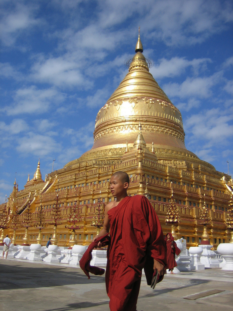
A Shan Couple
Click here for a larger view